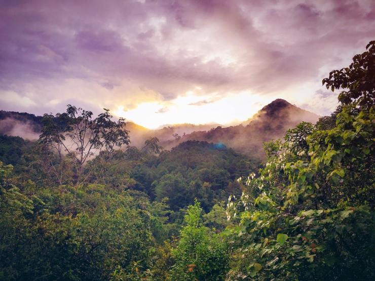
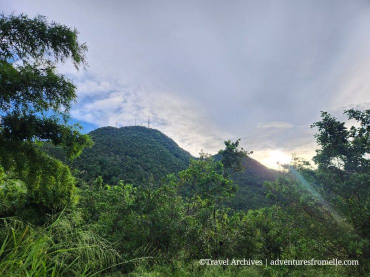
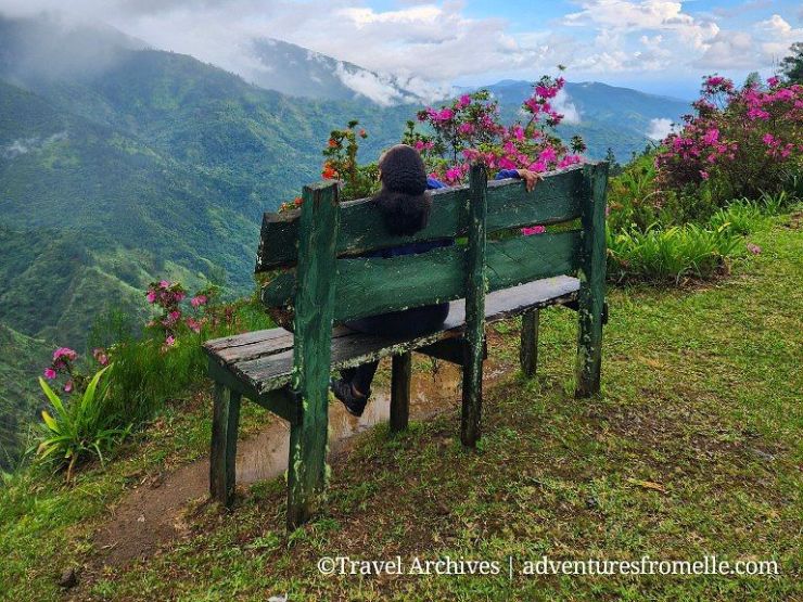
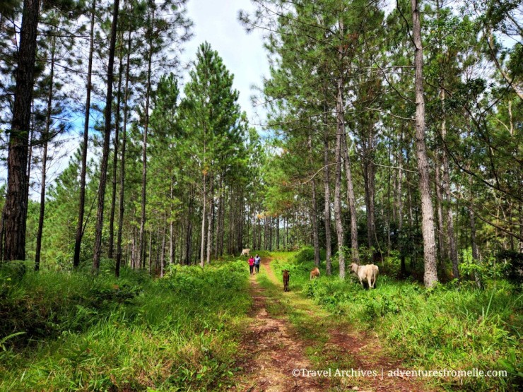
The Cockpit Country is Jamaica’s last true wilderness. With its dramatic limestone hills, thick impenetrable rainforests, numerous caves, sinkholes and vibrant Maroon villages, the Cockpit Country offers a rich mix of nature, history and culture. It’s also Jamaica’s largest mountain range at three times the size of the Blue & John Crow Mountains, measuring 780km2 and spanning five parishes. That being said, the Cockpit Country receives significantly fewer visitors because its karst landscape, high humidity, dense vegetation and limited surface groundwater make it an inhospitable and unforgiving destination. However, those who make the trek are in for a treat as the Cockpit Country is very beautiful and home to a large portion of Jamaica’s biodiversity. For travelers seeking an off-the-beaten-path adventure, here are seven unforgettable things to do in the Cockpit Country.
Continue reading “7 Things to Do in Jamaica’s Cockpit Country”Catherine’s Peak: St. Andrew’s Highest Point
Catherine’s Peak, located in the Jamaican Blue Mountains, is the highest point in the parish of St. Andrew. This peak is named after Catherine Long, the wife of Sir Henry Moore who served as the Governor of Jamaica in the mid-1700s, as she is believed to be the first white woman to climb the 5,050-foot-high peak in 1760. Catherine’s Peak is an easy trail– perfect for beginner hikers, and starts at Newcastle, the JDF military base nestled in the Blue Mountains. Here’s everything you need to know about hiking to Catherine’s Peak.
Continue reading “Catherine’s Peak: St. Andrew’s Highest Point”Gourie Forest Reserve: A Hike & Caving Guide
Tucked away in the mountains of north central Jamaica lies the Gourie Forest Reserve near Coleyville, Manchester. This beautiful mountain park falls under the auspices of the Forestry Department, a public agency responsible for Jamaica’s forest resources. Lying on 265 acres of montane land at 2000 feet above sea level, the Gourie Forest Reserve is also home to the Gourie Caves, Jamaica’s longest cave system. I’m pleased to report that Gourie is once again open to the public for visits, and who better to visit Gourie with than Trekkers Adventures Jamaica! Here’s how this adventure went + everything to know about visiting the Gourie Cave and Nature Reserve.
Continue reading “Gourie Forest Reserve: A Hike & Caving Guide”Cinchona Botanical Garden, Saint Andrew
Nestled in the Blue Mountains, Jamaica’s first UNESCO World Heritage Site, this beautiful botanical garden is named for its cinchona trees which were first planted in 1868. Cinchona trees are used to make quinine, a medicine used in the treatment of malaria, the serious mosquito-borne illness which has been eradicated from Jamaica since 1965. Located at between 4500 and 5500 feet above sea level, Cinchona Botanical Gardens boasts the record of Highest Botanical Garden in the Western Hemisphere. For these reasons, Cinchona has long been on my Jamaican bucket list but visits require either a 4×4 or hiking with an experienced guide. As such, I finally accomplished the trek with the illustrious company of Trekkers Adventures JA. Here’s how this adventure went + why you should visit!
Continue reading “Cinchona Botanical Garden, Saint Andrew”Why Hiking Is My Favourite Form of Exercise
I’m not as active as I once was, but if there’s a hike or long nature walk involved– sign me up! This is my favourite form of exercise because it does not feel like exercise. I love the smells, sights and sounds of nature so much that I hardly notice my aching feet, thighs and calves until the walk is over. And by then, I would’ve met my 10,000+ step count for the day. Sounds like a win-win to me.
Continue reading “Why Hiking Is My Favourite Form of Exercise”Bull Head Mountain, Clarendon
The Bull Head Mountains is a 545-acre mountain range located in north Clarendon. The mountain is named for its shape of a bull head when seen out from sea. Bull Head Mountain Peak is located at 3600 feet (1097m) above sea level, and the gentle trail which leads to it is one of the best hiking trails in Jamaica. The Rio Minho, Jamaica’s longest river, originates in the Bull Head Mountains and its natural spring water is bottled straight from the source. What’s even cooler about these mountains is that they contain the geographical centre of Jamaica and there’s a marker to prove it. This post covers how to find the geographical centre of Jamaica and the Bull Head Mountain Peak.
Continue reading “Bull Head Mountain, Clarendon”