The Bull Head Mountains is a 545-acre mountain range located in north Clarendon. The mountain is named for its shape of a bull head when seen out from sea. Bull Head Mountain Peak is located at 3600 feet (1097m) above sea level, and the gentle trail which leads to it is one of the best hiking trails in Jamaica. The Rio Minho, Jamaica’s longest river, originates in the Bull Head Mountains and its natural spring water is bottled straight from the source. What’s even cooler about these mountains is that they contain the geographical centre of Jamaica and there’s a marker to prove it. This post covers how to find the geographical centre of Jamaica and the Bull Head Mountain Peak.

Before we get into the article, please subscribe for new adventures.
Support the writer by purchasing her books. Also, shop Jamaican wall art at sheldonlev.com (10% Discount Code: ELLE10).
How to Find the Bull Head Mountains
Clarendon is one of Jamaica’s south central parishes and the least touristy. Nonetheless, there are attractions in Clarendon worth visiting such as the Milk River Bath with some of the most radioactive therapeutic waters in the world. There are also a few watering holes and waterfalls which I captured in my book Sightsee Jamaica. Last year I visited the Brae Head Falls in north Clarendon. While on that hike, my guide pointed out the Bull Head Mountain Peak which piqued my interest in visiting even more. Through that waterfall article, I formed a contact with someone who could serve as my guide to the peak and the rest is history.
The drive to Bull Head Mountain Peak took me through the quaint town of Chapelton with its iconic clocktower. I picked up my guide in Pennants, then drove through some tiny districts– some of which are not even on the map. We could see the Rio Minho for most of the drive but different sections of the same river had a different local name depending on the community. For example, there was a tiny district called Pumpkin (which does not in fact grow pumpkins), therefore the residents of that community call it Pumpkin River. I found this very amusing.
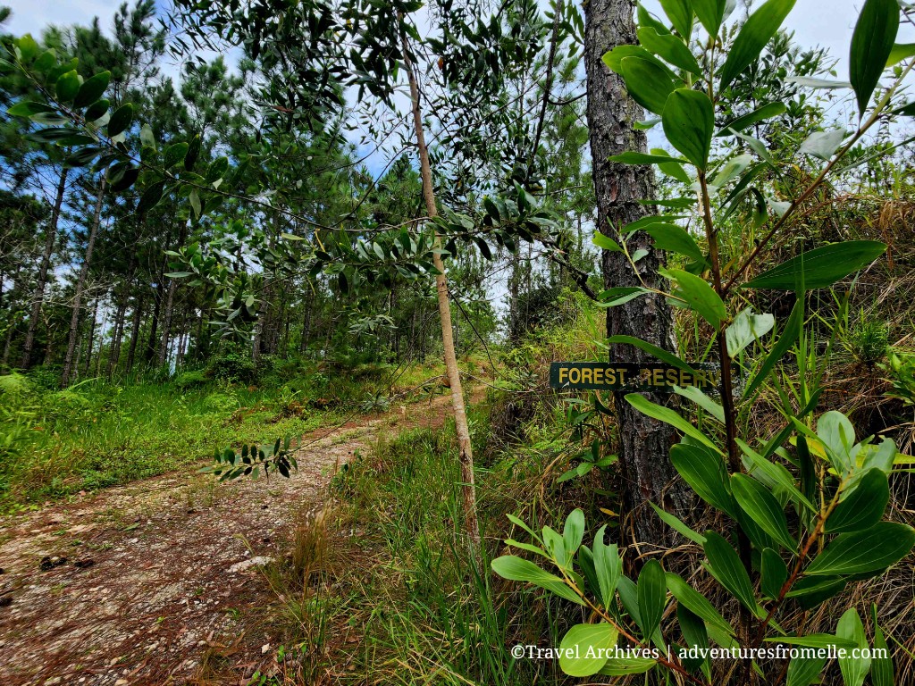
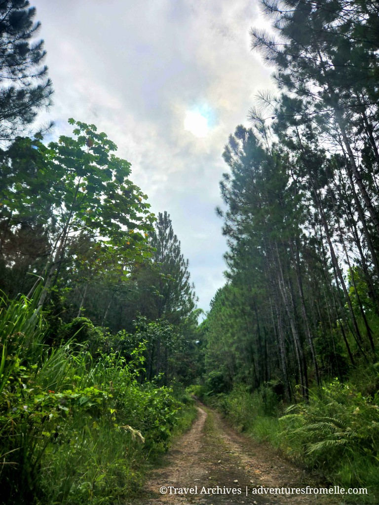
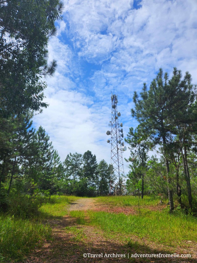
The road got more deplorable the closer we got, until it was reduced to a dirt track. However, it was clear that this track was well trafficked as we saw lots of tire marks. The area is often visited by members of the Forestry Department, Digicel workers who visit to maintain their phone cell tower and residents of neighbouring farming communities. There is no official parking spot; Bull Head Mountain is truly off-the-beaten-path. We parked by the widest section of the road then began our hike. Due to the lack of adequate signage, an experienced guide is a must.
Geographical Centre of Jamaica
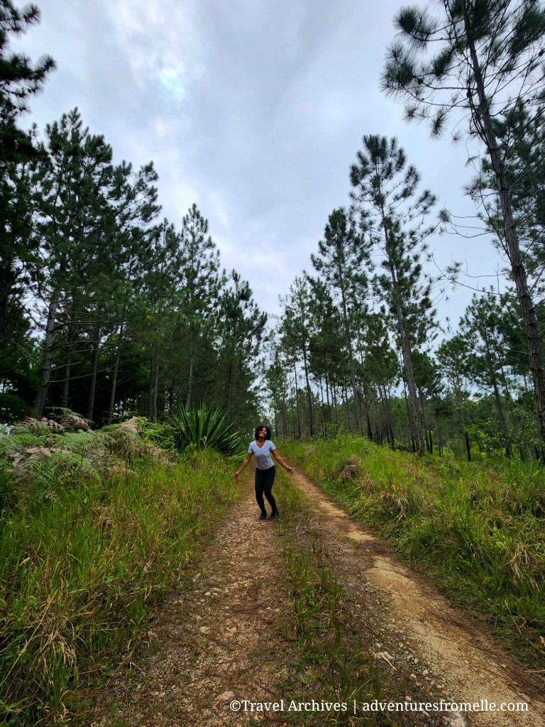
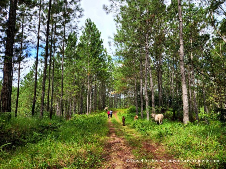
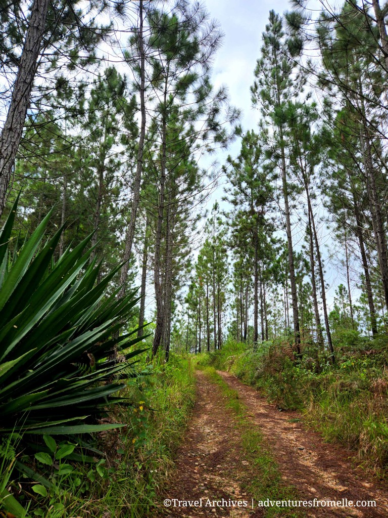
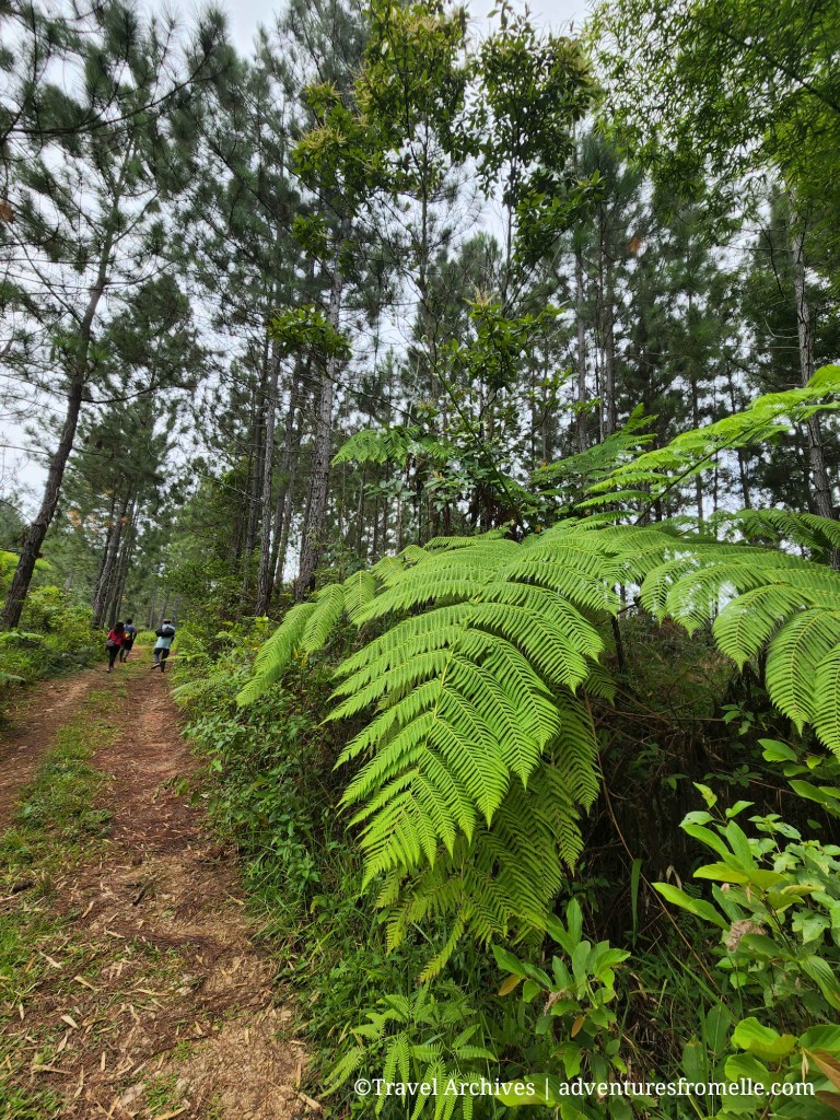
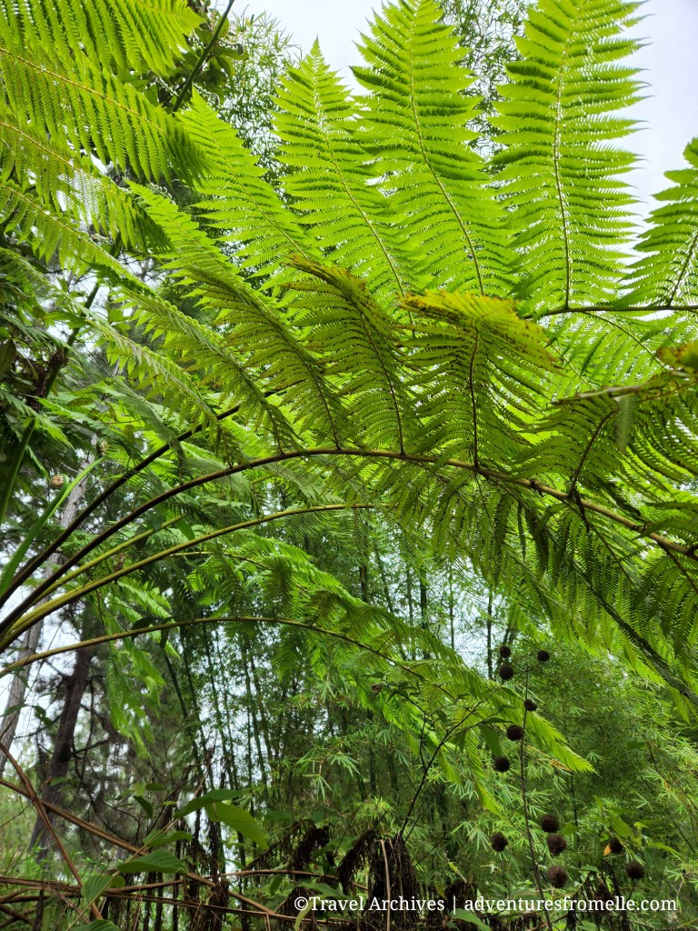
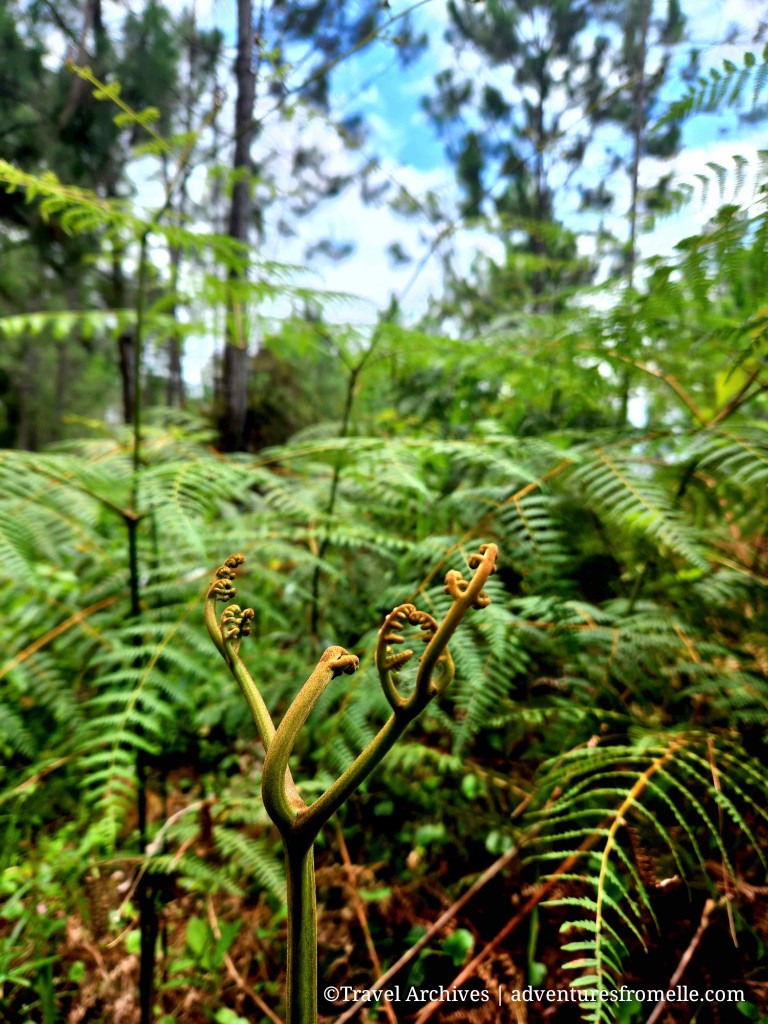
While this trail is unknown to most Jamaicans, it is a chill spot for Clarendonians. There is an annual fair and nature walk to the geographical centre on Ash Wednesdays which receives islandwide support. We walked for about 30 minutes before reaching the marker for the island’s centre. It could’ve been shorter if we didn’t stop so often for photos but we couldn’t help ourselves! The trail was so beautiful with the towering fragrant pine trees. I added new pine cones to my collection. Wild ferns including my favourite, the tree fern, were abundant. We spotted dozens of blue mahoe saplings which were recently planted by the Forestry Department because they are sturdier than the pine trees. Thus, the landscape of Bull Head Mountain will be completely transformed in a few decades. The pine trees aren’t doing so well from the slash and burn farming technique used by some residents, as well as malicious persons who set fires.
Blue Mahoe is the national tree of Jamaica.
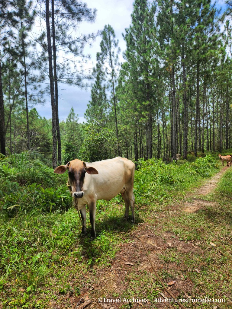
The scenery reminded me of an American forest, minus the cows. They were blocking the trail but moved for us to pass. Cows are temperamental animals but generally don’t harm humans unless they feel threatened. The cows looked at us quizzically, as if wondering why are these humans here.

The marker for the island’s centre is inconspicuous. Nonetheless, we found it and took pictures next to it. The land surrounding it is flat and someone had the foresight to place a picnic bench there. We didn’t carry a picnic basket, but the bench made a great photo op.
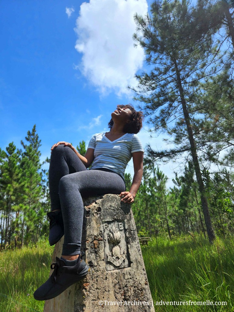
Sitting at the centre of Jamaica 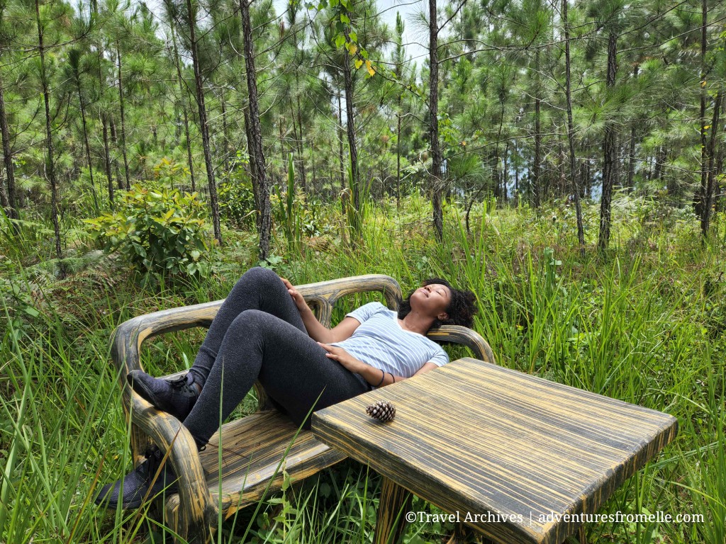
The forest is FOR REST 🙂
Bull Head Mountain Peak & Trail
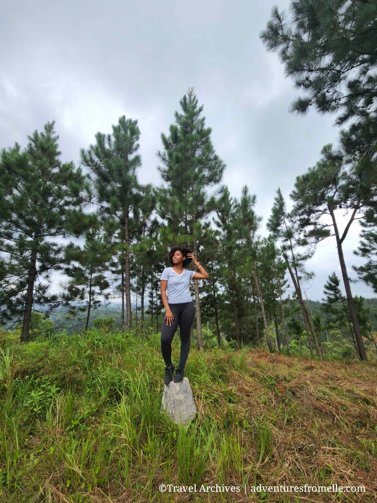
The only thing more temperamental than the cows on this trail was the weather. Bull Head Mountain gets almost daily rainfall and is affected by lightning storms. For that reason, we began hiking early and didn’t tarry at the geographical centre. From there, we continued to the peak which was 20-30 minutes away. The mulch which surrounded the newly planted mahoe trees made the trail feel like a carpet. On the way up, we were treated to gorgeous views of nearby Manchester but four other parishes can be seen from the peak, namely: St. Catherine, St. Mary, St. Ann and Trelawny. This trail was steeper so I took fewer pictures. I focused on breathing deeply and stepping carefully to avoid any slips on the damp mulch. This marker was just as inconspicuous. Let’s petition to get Bull Head Mountain Peak a trig station similar to that at Blue Mountain Peak.
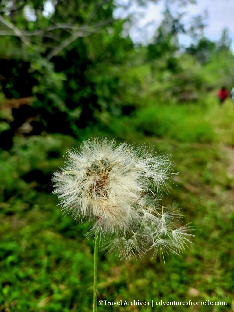
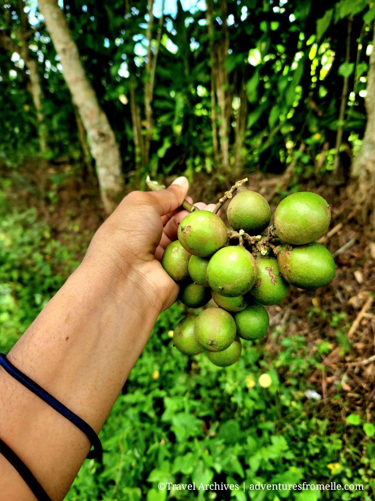
After basking in the achievement of conquering another mountain peak, we began our descent. We saw the purple vervain plant which is allegedly good for colds and covid-19. This plant was in high demand during the height of the pandemic as a natural remedy to the virus. However, it is not to be confused with a similar pink variety that is poisonous. I enjoyed the simple pleasures of blowing a dandelion seedhead and eating freshly picked guineps. We pay so much for these in Kingston. I also saw my first eucalyptus tree, and learnt that Cudjoe, the famous Maroon warrior, hid for a while in the nearby Colonel’s Ridge which lies to the south of the range. Hence, there’s a trail named for him.
Wrap Up + A Warning
The morning I spent in the Bull Head Mountain was wonderful. My style of travel has evolved over the years but off-the-beaten-path hikes remain my favourite. Hiking is my favourite physical activity because it doesn’t feel like exercise at all. I’ll gladly hike for hours once it’s not too hot or humid. I always learn something new on a guided nature walk. However, I’ve become a lot more cautious too. Crime has been steadily increasing in Jamaica. I’ve heard reports of people getting robbed at gunpoint at some of these hidden spots (e.g. Kwame Falls) since social media make them popular for both tourists and hoodlums alike. Please be vigilant and exercise caution when traveling off-the-beaten-path in Jamaica. Go in large groups and with a guide from the community where possible.
Anyway, I hope you’ve enjoyed this article. Share, pin and bookmark Bull Head Mountain for later. Remember to subscribe for new posts.
‘Til next time.
Find Elle on Facebook, Pinterest, Instagram, YouTube and Amazon.

[…] Go hiking to the top of Bull Head Mountain to Johnson Crawle Waterfall. Check out Adventure from Elle for details about the […]
LikeLiked by 1 person
Hi There
LikeLike